Objective
The basic objective of this lesson is that how geography can be identified as a landscape science. In this lesson, an attempt has also been made to explain how the study of scenery makes geographical studies more rational and practical. Again, through this lesson, we will also be able to know about the contribution of various scholars in the development of this important branch of geography.
Introduction
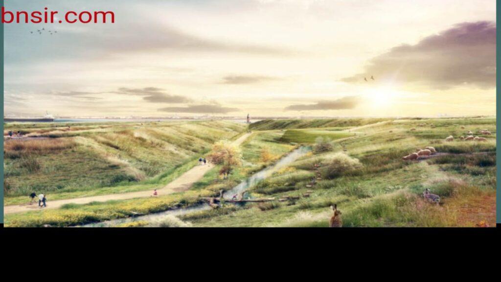
The scenery that is visible on the surface of the earth is colloquially called geo-image, geo-view, tireless scenery. It is a combination of innumerable landforms with or without water and vegetation cover. Changes keep coming in it continuously. The study of the shape or form of contemporary landforms, the causes, factors and processes of the plate landforms of this form and the changes in them is one of the many goals of geography.
Such studies have given prestige to this subject. From Humboldt to Hartshon, many scholars have expressed their views on the landscape. Yet, what is the sceneland, it is still not clear. The main reason for this ambiguity is that the term ‘Landschaft’ used in Germany for landscape was used there in many different senses. Even the same scholar has used this word in different meanings at different places. So it becomes necessary to understand the real meaning of this word.
Meaning of Landscape
It is the word used in English for landscape. The word evolved from the German word Landschaft, yet the two words are not considered synonymous. Along with the development of the word landscape, many Regions were added. Hartshorn has said that different scholars including Humboldt, Homeyer, Oppel, Froebel used the term landscape in different ways or with different meanings.

Generally landscape was understood to be the scene of the Earth Surface. According to Hartshorne, from landscape The outer part of the earth located below the atmosphere (form) can be considered.
In Germany the word Landrift was used for landscape. According to Hartshorne, the term Landschaftsbild in Germany was considered synonymous with landscape. Richardhafen, on the other hand, used the term die Erdoberfiashe for the Earth surface. Commenting on this predicament, Preston James said, “The scholar who uses the word landscape gives it a special meaning, even in a state of half-sleep.”
Woolridge and East suggested that instead of translating the technical terms used in German into English, it would be better to accept them in their original form. It is clear that these German words are related with the form and philosophy of different levels of territorial or regional units (Macro Meso, Micro units).
In the International Geography Conference (IGU 1938), many research papers and analytical articles on landscape and landroft were read.
In the opinion of the present scholar group, there is a need to do special research and other work to discuss the controversy arising out of the use of these words. According to the interpretation presented in the said conference, “A geographical landscape is not simply a physiological or an aesthetic entity; analyzes have shown that it embraces the whole range of generic and associated functional relationships between units on the earth surface enabling characteristic groups and sub-groups to be identified.”
Elements of Landscape
There is no consensus among the scholars on what elements are included in the landscape. Humboldt considered the aesthetic perception form as Landshaft. Generally, land shaft is understood as (i) the visible general form of a plot of land and (ii) the land surrounded by a definite boundary line. On the other hand, landscape only gives an understanding of the general appearance of a plot. The landmass surrounded by a definite boundary line is called ‘Pradesh’ or ‘Region’ in English.
According to Weibal, the landrift is that part of the surface and the sky which comes under the scope of the observer’s vision at the point of observation (place). Walter Feck included only those elements in the land scape which can be seen, but he did not include the man, only the elements expressing his impression on the surface. Graine included all sensory elements, not just the visual landscape, under the landscape. According to him, the landscape is the total impression which a piece of land and the sky above it make on the mind of man. This can be called Perceptual landscape.
Eluter also considered human elements as a part of the landscape. According to him, the effect of cultural environment and its factors on the landscape of a land should also be included. He further said that such factors can be both visible and invisible. But his disciples included only visible objects and visible influencing factors.

Pasarj talked about keeping humans as well as animals away from the stage. He was in favor of including only natural (non-human) elements under it. Taking a dig at Passarg, Bavel said that Passarg’s notion made the use of the word landroft more confusing. Pasarg considered the landscape to be a bundle of observable physical objects. On the other hand, Lauten also considered abstract elements like caste-species and linguistic conditions as an integral part of the this.
In short, it can be said that the community of geographers who used to consider the land shaft as a bundle of perceptual elements coming in the boundary of a part of the earth’s surface and the sky attached to it, all the scholars were not unanimous even on the elements included in it.
Every geographer considered all those elements, which he wanted to study, to be an integral part of the this. Even many geographers considered ‘State’ as its part. This is not because the state is an observable entity or influences observable entities, but because the ‘state’ is also a landscape phenomenon.
Relates to any element of. In this sense, Landshift becomes synonymous with only one area and remains unclear.
Shape-Extent of Landscape
Landshift has also been considered related to size expansion. Homeyer considered it as ‘Gegend‘ i.e. the familiar area around the place of residence of a person and the intermediate extension of the country. According to Grin’s Dictionary, a ‘landrift’ is a political unit whose extent is smaller than that of a country. Under this, the population of that unit is also included.
On the contrary, Craves believed – that the difference between land and landshift is not related to the difference in territorial expansion. The term land is used not only for national units such as England or Destsch-land (Germany), but also for smaller political regions such as Suuer-land.
In fact, the landscape is more connoisseur of the forms of a particular area, whether small or big, that express the uniqueness of that particular area. For example, Alpine landscape refers not to the nature of the alpine region but to its uniqueness.
Most of the modern geographers also use the term Landshaft in the sense of ‘region’. In this way, the landshift expresses the landscape of a limited area on the one hand, and on the other hand it also reveals a wide area with a definite characteristic (such as alpine landshaft).
The biggest difficulty arises when the same geographer uses it in different meanings at different places. Crowe has said that the German geographers have defined Landschaft in such a way that it includes all the elements that come under the ambit of geographical study, apart from the elements of direct observation.
The same trend is seen in the American geography community. Even in Karl Sauer’s book ‘Morphology of Landscap’, the difference between field and landscape has not been clarified. In this book also the words landrift and landscape are sometimes used in the same sense and sometimes a general difference has been shown between them.
Sauver said, “The landscape form is the characteristic area of the past soul-relationship.” Under this, both the nature of the natural area and the nature-rich natural landscape and the cultural land formed by human activities are included.
It is noteworthy that the entire landscape is not just a sum of natural and cultural landscapes. This is because man not only adds something to the natural area but also takes something out of it and in this way he also changes some part or some element of the natural landscape. in short it can be said
It is certain that the combination of the above two classes does not cover all the elements of a field.
Landscapes are linked to regional units, not surface-wide forms such as alpine landscapes. In his thinking, “Geographical area ie scenery is a physical element, whose formative specificity can be assessed, structure identified and origin, development and functioning discussed.
In this, the illusion of scenery and area remains. Keeping this fact in mind, Preston James said, ‘Landscape is a plot of land whose form remains the same from whatever point of view it is seen. American slang also uses its field of vision in its general form and its limited field.
In the first sense, the landscape is the totality of visible elements of a part of the surface and in the second sense, it is such a region in which some special symmetry is found in the morphology. Some similar interpretation of the landscape has also been done in Great Britain.
Role of Geographical Study
Studying landscape is primarily for the purpose of comprehensively explaining the characteristics of events and objects and their interrelationships in a plot. seems appropriate. According to Luther, the study of landscape is one of the main objectives of geography.
To place it in the table of contents of geography “is to make its (geography’s) definition more justified.” On the other hand, Hartshorne, in his book ‘Nature of Geography’, while explaining the landscape concept, has said that the biggest reason for the misconceptions about the landscape is to consider ‘geography’ as the ‘study of the landscape’. According to him, such a definition of geography is unnecessary.
Therefore it would be appropriate to reject it. In this vein, Dickinson and Kobre said, “Geography and landscape are quite different from each other.” Geography is not just the ‘study of the landscape’. In geography, human society, its (man’s) created form and their mutual relation with the bio world, environment etc., their diversity and their characteristics are also explained.

The many complex layers contained within will emerge and become visible. When the area is selected to study any rural or urban landscape, it is experienced many times despite the use of quantitative methods at all levels, according to the method commonly adopted in detailed description and research. That there are many geographical facts which are related to the above area but they cannot be included in the study by the method used.
Mulliard has beautifully explained the practical problems related to the geographical landscape. He believed that after collecting all the primary data and information for the study of the landscape of a unit area, with the help of them the geographical landscape can be divided into different phenomena and objects and the levels of invisible relations between them. Realligation should be done to establish those who reside in the cognitive brain. Only after this the interpretation of the above scene can be possible.
In the United States of America, Hartshon, Savar and many other scholars used the word ‘landscape’ freely. There this word was sometimes considered synonymous with the word ‘state’. Sauer, in his much talked about ‘Cultural Landscape’, is synonymous with landscape.
Agreed . He said that the description of the landscape of a plot should include both the natural features of that plot and the activities of its inhabitants.
On the other hand, criticizing this view, Brookfield said that landscape in such a limited sense Using it can push the interdisciplinary research of geography. he further Said that it is necessary to reconsider this problem.
From the point of view of analysis, landscape is an abbreviated expression of the surface. In its study, the forms of both physical and cultural scenes and their configuration and background are taken into account. Absence (absence) of any one or sometimes any two and exceptionally all three can be seen in the landscape of a particular area.
Such landscapes can sometimes be found in hot and cold deserts. Such scenery can only be mentioned as an example. They cannot be given a place in geographical or conceptual studies. They are specially studied in exploration physics and other physical sciences to know their direct and indirect far-reaching consequences and effects. Research on the Antarctic continent is an example of such a study.
In France, scholars like Blash, Bruce etc., in the first half of the 20th century, made an in-depth study of agriculture, farmers and rural areas and presented their interpretation. The problems of agriculture and farmers in rural areas were called ‘Milieu’ in the context of creation and development of areas. Between the two world wars, the above study was carried forward with the help of special surveys, aerial photographs, cadastral maps etc. Perhaps during this time the term ‘Agricultural Landscape’ came into use.
Vassarge, who was a leading scholar from Germany, said, “The study of landscape consists in identifying and describing the various features on the surface of the earth.” (The study of landscape involves the recognition and description of respective form on the earth’s surface.).
He described different areas of the surface as ‘Areal Variable of Landscape’. Pasarg explained the possible elements of landscape in the first volume of his famous four-volume book ‘Landschaft Kunde’. In its second section, he threw light on the events of the scene, their background and their factors and effective elements. In the third section of the book, the structure and process of the physical environment of the landscape, the special effect of climate and its ability to influence and the development of cultural elements and their contribution in the formation of cultural landscape are mentioned.
In its fourth section, Pasarg explained the complexities of the creation of landscape by elaborating on the form and features created by the effects of man and nature and the relationship between them and their wider background. In this section, he also threw light on the units of scenery. There is a similarity between the views of Pasarj and Schluter.
According to Q Aluter, the immaterial elements of an area such as political organizations, economic institutions and statistical means should not be given place in the table of contents of geography. He said that to a geographer the most
First of all, the visual knowledge (understanding by seeing) of the configuration of objects or elements on the ground level should be obtained. After that he should carefully observe the Perception contained in them with the help of his experience. According to him, the totality of such Perception is the complete scene of the said area.
While explaining the topography, both Eluter and Heitner considered it important to understand the variation of the surface areas and to model them by understanding their characteristics. Both believed that the earth’s surface can be divided into regions with distinct characteristics. Certainly such areas will be different from the surrounding areas. In each of these there will be an internal symmetry. Schluter has explained the necessity of understanding the landscape to understand all such facts.
It is worth mentioning that while Hattner gave importance only to the target basic pattern on the surface of the regions or regions, Schlüter went a step ahead and considered the relationships (interrelations) between the features found in them in an attempt to format the uniqueness of the regions. Thus, this idea of Eluter seems similar to Hartshorne’s interpretation of decision making based on areal differentiation, interrelationships of different levels and their internal homogeneity.
Leo Weibal has used the term ‘Landshaft’ in the study of small areas of the Earth’s surface. Whatever physical and cultural visual characteristics or forms created by the combination of specific effects hidden in a plot are visible at present, they do not happen suddenly or in a moment.
Time has a deep impact on such a form structure. When the landscape of an area and its special elements are studied, more importance is given to its present form, characteristics and the factors affecting it. If any decision has to be taken regarding future possibilities through such study, then one has to look towards the past. In this situation, the time factor becomes strong.
In the current geographical studies, the importance given to region, region and landscape was never given before. This is also necessary in view of the needs of regional planning and regionalization which are rapidly developing after the Second World War. Modern quantitative methods and techniques such as aerial photographs, tele-sensing, computer analysis, GIM etc. accelerate this trend.
Today in the past, importance is given not only to cause and effect, but also to give importance to sequence of cause and effect. Along with this, more emphasis is being laid on determining the factual authenticity, process and nature of relationship in geographical analysis.
Conclusion
It was developed from the German word ‘Landschaft’, although many scholars considered these two words synonymous, while many others gave them different meanings.
The term ‘Landshaft’ has been used by different scholars Used in different ways and with different meanings. It is surprising when the same scholar is found using this word in different places with different meanings. According to Hartshorne, ‘Landscape’ can be considered as the outer cover of the earth located below the atmosphere.
In this way there is no consensus among the scholars on the meaning of scenery, there is no agreement among them as to what elements are included in scenery. Generally, ‘Landshift’ is understood to be a plot surrounded by a normal form and a definite boundary line. This also does not fit in the context of both the above mentioned words, because the plot surrounded by the definite boundary line is called region or region in English.
According to Webel, the landrift is that part of the surface and the sky which is included in the field of vision of the observer at the point of observation. As far as the elements of visible land are concerned, some consider them as visible objects, some as invisible, some consider them as things that express the impression of man on the surface, some consider them as natural non-human objects and even many consider them as sensuous substances. Many scholars accept such tangible or intangible substances as the influence of the environment, caste, racial and linguistic conditions as its elements. Here also there is no consensus.
In terms of size, some consider it as small as the residence of a person and some as big as the (size) of the country. Many scholars consider the study of landscape to be the main purpose of ‘geography’ and many others believe that the reason for the misconceptions related to landscape is to consider ‘geography’ as the ‘study of landscape’. Geography and scenery have also been described as completely different from each other. But most scholars believe that the study of landscape is an essential part of geography.
For many purposes or in order to find solutions to many problems, the study of scenery is done in geography. Many scholars have given their own suggestions on which aspects of landscape should be studied in geography and what should be the method of study. In almost all the major countries of the world, landscape has been studied in geography.
Therefore, it has to be accepted that all that is included in the landscape which comes under the purview of the study area of geography. In the end, it can be said that if it is accepted that both physical and cultural landscape are included in the concept of landscape, then there is no difference between the study of geography and landscape.
you can understand with from YouTube Vedio 🎬

